Winter may not be over yet, but just by looking around you would think it ended weeks ago. The few signs that remain of winter slowly melted away last week as temperatures soared into the 40’s. According to Dr. Scott Steiger the local co-op observer for the National Weather Service, we’ve only received forty-nine point one inches of snow as of February 29th.
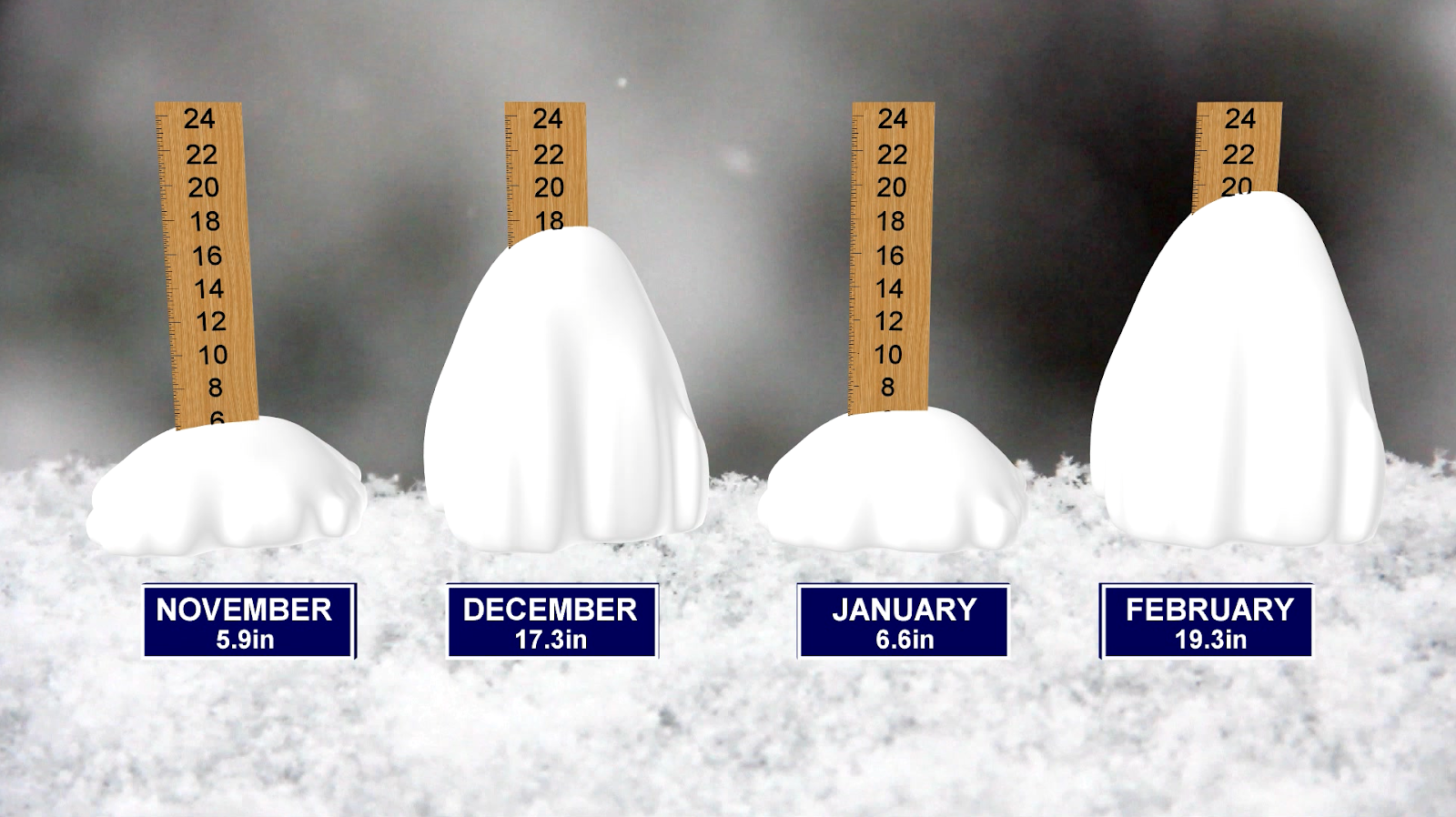
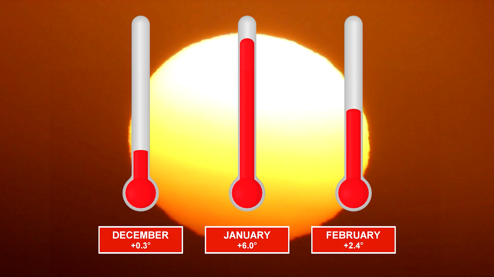
An alarming seven feet below the average snowfall for this time of year. Though it’s not surprising that we’ve seen so little snowfall, through the winter months Oswego ran 2.9 degrees above average temperature-wise. January saw the worst of the effects of the warm winter at an amazing 6 degrees above average.
Students, either way, have taken advantage of the spring-like conditions and have used the time to spend their days outside. While others were left waiting for the snow that never came like Florida native Bruno Rojas. Bruno had this to say about the past winter in Oswego “There weren’t that many lake effect events in Oswego so you never really got to see…big snow storms, where you could just sit down you know in the snow and just kind of watch the really big snowflakes kind of fall really gracefully. ”
Many have expressed similar views, asking constantly where was winter this year? The answer? There was a strong Arctic Oscillation or AO, that was in its positive phase. When it’s in a positive phase we oftentimes see a lot of the cold air trapped up in Canada. It’s when it enters its negative phase that it starts to allow the colder air to funnel down into the United States. and that’s what allows for those cold Oswego winters that we all know.
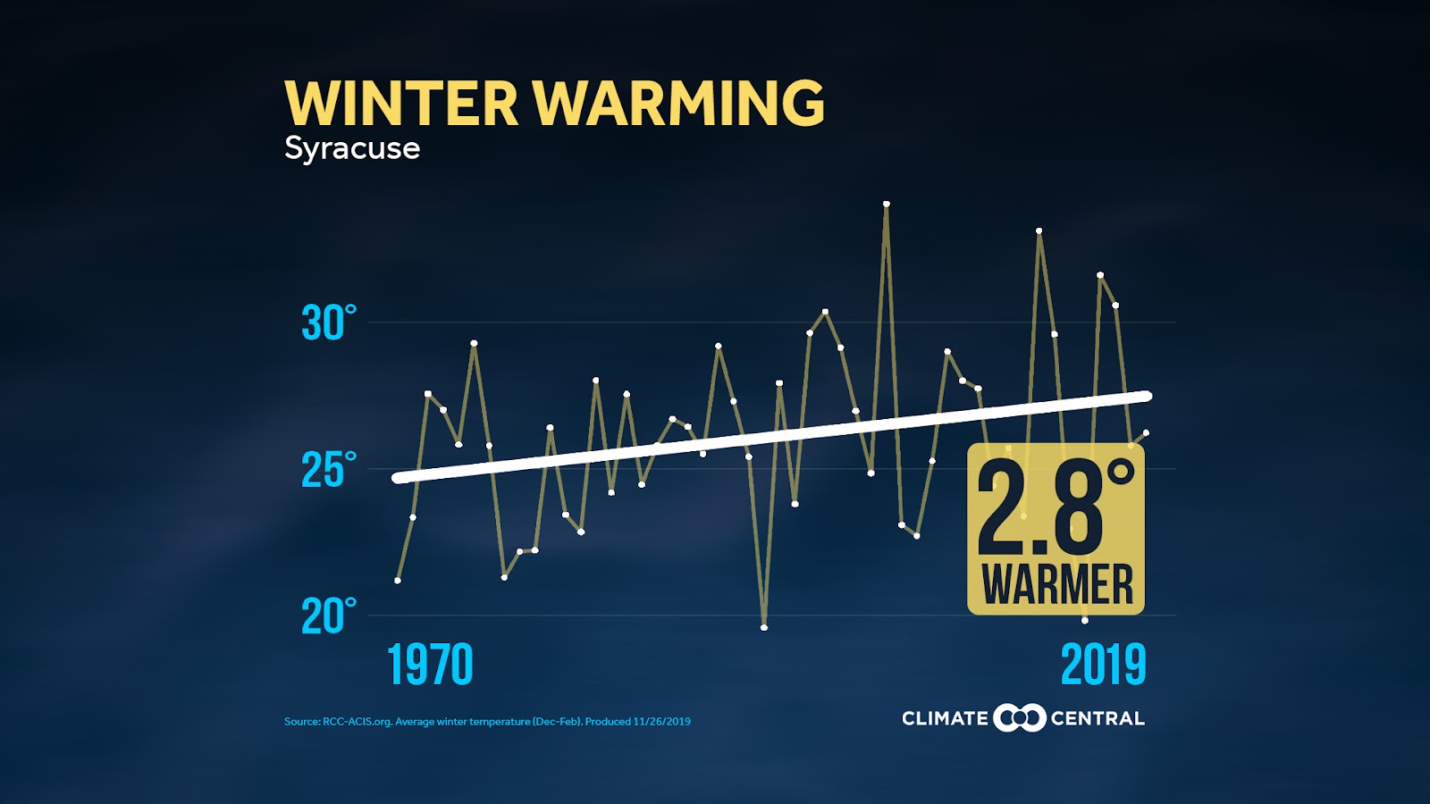
While this was certainly an anomalous winter, it is part of a longer-term trend of winter warming across upstate New York. The trend becomes obvious on this chart from climate central, showing how Syracuse’s average winter temperatures have warmed 2.8° since 1970. While this chart is only for Syracuse, the changes can be seen all across New York as our climate continues to change.
-
Oswego Nightly News – Tuesday April 2nd 2019
Post Views: 194
-
Student Association Update: November 10th
On Tuesday evening, the 53rd Student Association met for the ninth official time of the semester. The number of senators to make a quorum were present, and Executive Vice President Emily Nassir called the meeting to order.
The Oswego State Cheerleading Team kicked of the meeting as a guest to the Senate. The Cheer team asked for an increase in their budget this year as a result of the team growing in size. They currently have thirty-six members on the team. To ensure that all get a chance to travel to Nationals in Daytona Beach this April, they’ve turned to the Student Association to help with transportation, hotel, uniform and food costs. In previous years the Cheerleading Team have relied on sponsorships to fund their trip, but after handing out over forty letters, and only receiving three, they felt it would be wise to reach out for funding. Their budget proposal and official budget structuring will be overseen by the finance committee next week.
There was no public comment, so the meeting moved into the next section, executive reports.
Student Association President Christopher Collins-McNeil, shared his experience from the Net Impact Equity Premium Group Conference in Seattle, which he had attended over the weekend. Collins-McNeil briefly described it as “one of the most powerful experiences at a conference.” He stated that he would go further into detail next week about his time spent in Seattle.
Student Association Director of Finance Matthew Peters then took the floor. Peters spoke about a proposal to change the fifty percent rule, regarding the purchasing of items for clubs and organizations on campus. A change in the rule would give each student club or organization control over its own budget, with the advisement and approval of the Director of Finance and the SA President. It is up to the rest of the Senate to vote on whether the fifty percent rule should change or not.
The meeting then progressed into Hall Council reports. Waterbury Hall announced that students are no longer restricted to only using the lounge on their floor. Students now have access to any lounge in the hall. Waterbury Hall also reminded the Senate that their Laker Life program Glow Jam, will be on December 4th. They encouraged all Senate members to attend the event and spread the word. Cayuga Hall spoke on combating the issue of bullying in their residence hall. The hall has organized a program against bullying where students will post index cards and post-its with encouraging words in the hallways of Cayuga Hall.
No new legislation was introduced, therefore the meeting came to a close and the senators dismissed.
Student Association Senate Meetings take place every Tuesday at 6pm, in Lanigan 107. There are only two meetings left in this semester, November 18th, and December 4th. All meetings are open to the public and students are encouraged to attend and present on any issue.
-
Women’s hockey beats Williams
This weekend, the women’s hockey team travelled to Willamstown, MA to take on Williams.
On Saturday, the Lakers would defeat the Ephs 7-2. At the end of the second period, the Lakers were up 2-0. In the third period, Alexa Aramburu would contribute to the five goal period by scoring three out of the five goals. This would be Aramburu’s second-career hat trick. Olivia Ellis also had a great game scoring one goal and assisting on all three of Aramburu’s goals.
On Sunday, the Lakers would again defeat the Ephs, but this time only by a score of 1-0. The lone goal came from Alexa Aramburu in the second period. Jacquelin White and Olivia Ellis assisted Aramburu’s goal. Mariah Madrigal recorded her second shutout of the season and seventh victory. Madrigal stopped all 32 of the Ephs’ on-goal attempts. She has now made 25 or more saves in each of her last three outings, all culminating in wins.
The Lakers will return home this weekend and play Canton in a Friday night game and a Saturday afternoon game.


